Tokyo · A day in the woods
The last stop, then the trees
Mount Takao from Tokyo: choose your walk, leave room for the mountain
A temple among the cedars, a stream underfoot, a train home. There is more than one way to spend a day on Tokyo’s western edge.
The Keio line ends at Takaosanguchi. A short walk beyond the station brings you to a choice: ride into the trees, take the temple approach on foot, or follow a stream into the mountain. It is a good place to arrive with a loose afternoon and a reasonably clear idea of how much climbing you want to do.
Takao is close enough to Tokyo to fit between city days. That convenience can make it sound like a park with a viewpoint attached. It is still a mountain. The summit stands at 599.15 metres, paths climb, and the cable car leaves you partway up. Getting there is easy; deciding what kind of day to have deserves a little more attention.
For a first visit, the most satisfying plan is often the least ambitious: use the cable car for the lower climb, walk Trail 1 through Yakuoin, and return while there is plenty of daylight. If you want the walking itself to be the day’s main event, the stream-side Trail 6 offers a different journey. Neither needs to become a race through every numbered route.
The walking comes first
Three paths, three different afternoons
The route numbers are useful on signposts. They are less useful as a ranking of what you ought to achieve. Start with the experience you want, then look at the ground and the starting point.
| Route | Where it starts | Published uphill time | What changes the walk |
|---|---|---|---|
| Trail 1 · the temple approach | From the base; the cable car can replace the lower climb | 1 hr 40 min from the base | Paved, with a steep lower section and stairs above Yakuoin |
| Trail 4 · the suspension bridge | Near Joshinmon, partway up the mountain | 45 min for the Trail 4 section | Narrow woodland path, stairs and the Miyama Bridge; bypasses Yakuoin |
| Trail 6 · the stream route | Near the cable car’s Kiyotaki base station | 1 hr 40 min from the route’s base | Unpaved, with stepping stones, narrow sections and a long final staircase |
Visitor-center standard uphill times are walking estimates. They exclude stops and queues. Trail 4 starts higher up: its 45 minutes is not a station-to-summit journey.
Trail 1: take the temple seriously
Trail 1 is the main approach to Yakuoin. Its paved surface makes navigation straightforward, but the first climb from the base is steep. Riding that lower section is a perfectly good decision if you would rather spend your energy among the cedar trees and temple buildings. From the upper cable-car station, you join the same pilgrimage approach.
At the fork between Otokozaka and Onnazaka, one branch takes stairs and the other takes a sloping path. Choosing the slope does not make the entire route step-free: there are more stairs farther up. If mobility is a concern, ask the operator and visitor center about the exact section you intend to visit, rather than relying on the word ‘paved’.
This is the route to choose when the temple, the forest and a few pauses matter as much as reaching the top. Build those pauses into the plan. A cable-car ticket saves some ascent; it does not buy a fixed arrival time at the summit.
Trail 4: a woodland detour, not a shortcut to everything
Trail 4 branches near Joshinmon and reaches the summit area by way of the Miyama suspension bridge. The visitor center describes a narrow path through deciduous woodland, with many stairs and a descent that can be slippery. Its attraction is the forest section and bridge, not the promise of an easier climb.
It also bypasses Yakuoin. If you ascend on Trail 4 but want to see the temple, return on Trail 1 or plan the temple separately. That small piece of geography matters more than the route’s shorter published time. On a crowded day, a narrow trail may move at the pace of the people ahead of you.
Trail 6: give the stream your morning
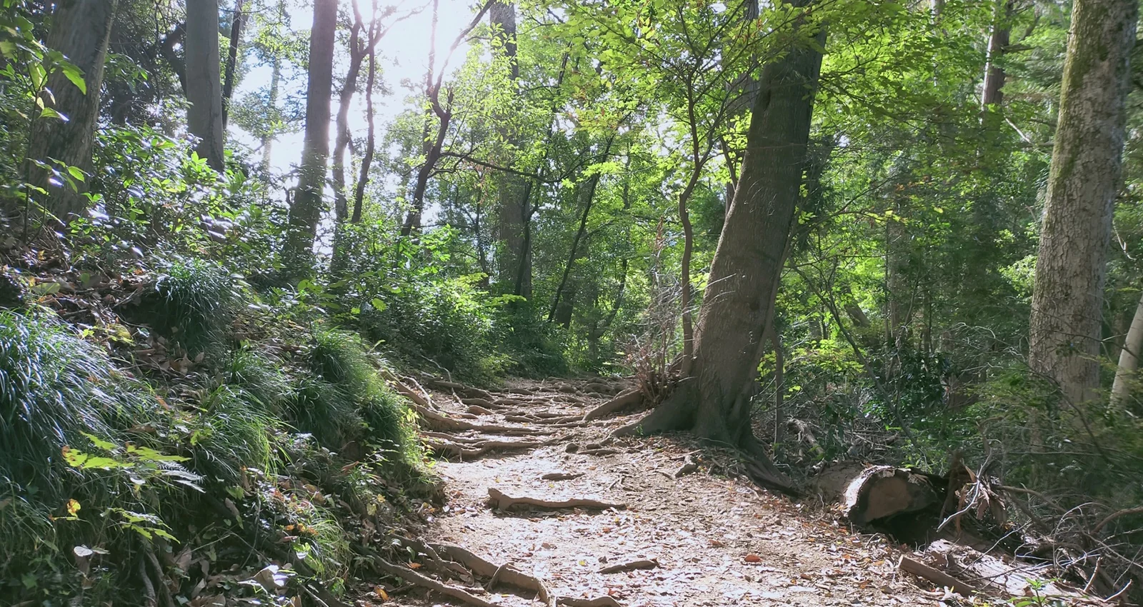
Trail 6 begins near Kiyotaki and follows water rather than the main temple approach. It passes Biwa Falls, still used for religious waterfall training, then reaches a stepping-stone section before the final stairs. The walking has a different texture here: an unpaved track, uneven footholds and stretches where passing other hikers takes care.
Choose it for a proper walk in suitable shoes, not as a hidden way to avoid all the crowds. The visitor center specifically notes congestion on narrow routes. Rain can change the footing, and seasonal direction restrictions can change how you use the trail. Check the current notices; a one-way rule from a previous autumn is not a rule for November 2026.
Trail 6 does not take you through Yakuoin on the ascent. Returning by Trail 1 gives the day a different second half, with the temple on the way down. Make that choice before setting out, and keep enough daylight for the return. There is no need to add another summit or extend into Oku-Takao just because the map continues west.
A little help with the climb
Cable car or chairlift?


The cable car is an enclosed rail carriage hauled up the slope between Kiyotaki and Takaosan Station. The chairlift is open, with two-seat chairs, and takes about twice as long. Both reach the mountainside and connect you with Trail 1; neither delivers you to the summit. Think of them as two ways to replace the lower ascent.
The operator lists the same individual fare for either ride: ¥490 one way or ¥980 return for adults; ¥250 one way or ¥500 return for children. These are mountain-transport fares, separate from the train to Takaosanguchi. Keio also sells a combined Mount Takao ticket; compare its current terms with the route you actually intend to use.
A return ticket can suit a day built around the temple approach. A one-way ticket may make more sense if you plan to walk one direction. Decide after checking the weather, your legs and the day’s service notices. There is no virtue in choosing the longest possible descent when you are already tired.
The last ride is not the time to leave the summit
The regular September–November cable-car timetable ends at 17:45 on weekdays and 18:00 on weekends and holidays. The chairlift’s regular May–November finish is 16:30, with possible extensions. Special operations and weather can change these times. Read the day’s notice, then allow time to walk to the station and wait in line. The visitor center warns that the trails have no lighting; an evening transport service does not turn the mountain into a lit night walk.
Takaotozan Railway · rides, fares and regular timetable Takaotozan Railway · current operating notices Takao Visitor Center · course overviewA place of practice
Yakuoin gives the walk another meaning


Yakuoin traces its foundation to 744. Its later history connects the mountain with Shingon Buddhism and Shugendo, a tradition of mountain religious practice. The principal figure venerated here is Izuna Daigongen. This is a working religious place along a walking route, with its own rhythms and reasons for being.
The tengu figures are worth looking at slowly. In the temple’s account, these mountain beings act on behalf of sacred powers. One type has a long nose; another has a bird-like beak. Their forms carry associations with religious training and protection. A quick photograph records the shape, but a little context makes the figures more than curious decorations.
You do not need to book a religious experience to visit thoughtfully. Give worshippers space, follow signs about photography and access, and keep your voice appropriate to the setting. The temple is a reason to pause before continuing uphill, not simply an item to tick off between the cable car and the summit.
At the top
Leave Fuji out of the bargain

A clear day can bring a view of Mount Fuji. Treat that as a possibility, not the condition on which the entire outing depends. A cloudy horizon does not erase the forest you walked through or the temple you stopped at. The summit is also a shared space; in busy seasons, finding a quiet seat can take more patience than reaching the top.
The visitor center flags the summit’s late-morning-to-early-afternoon lunch period as especially congested. Instead of building the whole day around eating at the busiest viewpoint, carry something simple and choose a suitable stopping place along your planned route. Stay on designated paths and spaces, and take every wrapper home.
This is a good moment to decide whether you have had enough mountain for one day. Check the time, the weather and how everyone is feeling before beginning the descent. Reaching the top is one part of the outing; the trip is not finished until you are comfortably back at the base.
The seasonal edition
A festival date is not a leaf forecast

The local tourism association describes mid-November to early December as the usual foliage season. That is a planning window, not a prediction for every slope in 2026. Leaves change at different times, and a photograph of a red canopy cannot tell you what the mountain will look like on your date.
For the 2026 event period, GO TOKYO’s page updated on 29 September lists 24 October–13 December. At our check, the organizer’s Japanese and English programme pages still displayed 2025 details. Use the current city listing for the announced period, then check the organizer again before planning around a particular ceremony, giveaway or evening operation. We are not carrying last year’s programme forward.
An ordinary weekday gives you more room to change your mind than a tightly packed autumn weekend, though it will not guarantee an empty trail. Start early enough to keep choices open, and do not treat the cable-car queue as time you can recover by hurrying on the mountain. If the day is wet or visibility is poor, a shorter temple visit can be the better afternoon.
A few names to get right
Takaosanguchi is the train stop you want
Simple orientation · not a trail navigation map
- ShinjukuKeio rail route
- TakaosanguchiWalk · about 5 min
- KiyotakiCable car · about 6 min
- Takaosan StationTrail 1 on foot
- YakuoinContinue on foot
- Summit
From Shinjuku, use the Keio route toward Takaosanguchi. GO TOKYO gives about 55 minutes as a travel guide, but connections and service patterns vary: read the destination board and use a journey planner for your date. Takaosanguchi is at the end of the Keio Takao Line. Takao, without ‘sanguchi’, is a different station where JR and Keio connect.
If you arrive on the JR Chuo Line, transfer at Takao for the Keio leg to Takaosanguchi. Check the fare coverage of any rail pass you hold rather than assuming the mountain transport is included. From Takaosanguchi, the cable-car operator gives about a five-minute walk to Kiyotaki, its lower station. Takaosan Station, despite the railway-like name, is the cable car’s upper station.
For a first outing with the cable car and temple, keep roughly five to six hours at Takao as a comfortable planning allowance, including stops and a meal. That is our suggested budget, not an official course time. Add the journey from your Tokyo base and allow longer when queues, children or autumn crowds set the pace. A full day gives you permission to stop without constantly checking the next train.
Back at the base
A small museum can slow the day down


TAKAO 599 MUSEUM is about four minutes on foot from Takaosanguchi. Its plant and insect specimens invite a closer look at the mountain’s smaller inhabitants, while the Nature Wall uses projected images to introduce its ecology. It can make sense before the climb, when you are curious about what to notice, or after it, when you have something to compare with the exhibits.
General admission is free. The published April–November hours are 08:00–17:00, with last admission at 16:30; December–March closes an hour earlier. Some activities are charged and maintenance closures occur, so check recent notices. One already announced is 2 October 2026. Do not build a rainy-day backup around a museum without checking that it is open.
A shorter day here is still a day at Takao. If the weather closes in, there is no obligation to make up the missing summit with a more strenuous detour. Leave time for the museum, a rest near the station or simply an earlier train. The useful souvenir may be knowing that Tokyo has this other edge, and that you can come back without needing to do it all at once.
On the train home, the route numbers can stay on the map. What matters is the day you chose between them.